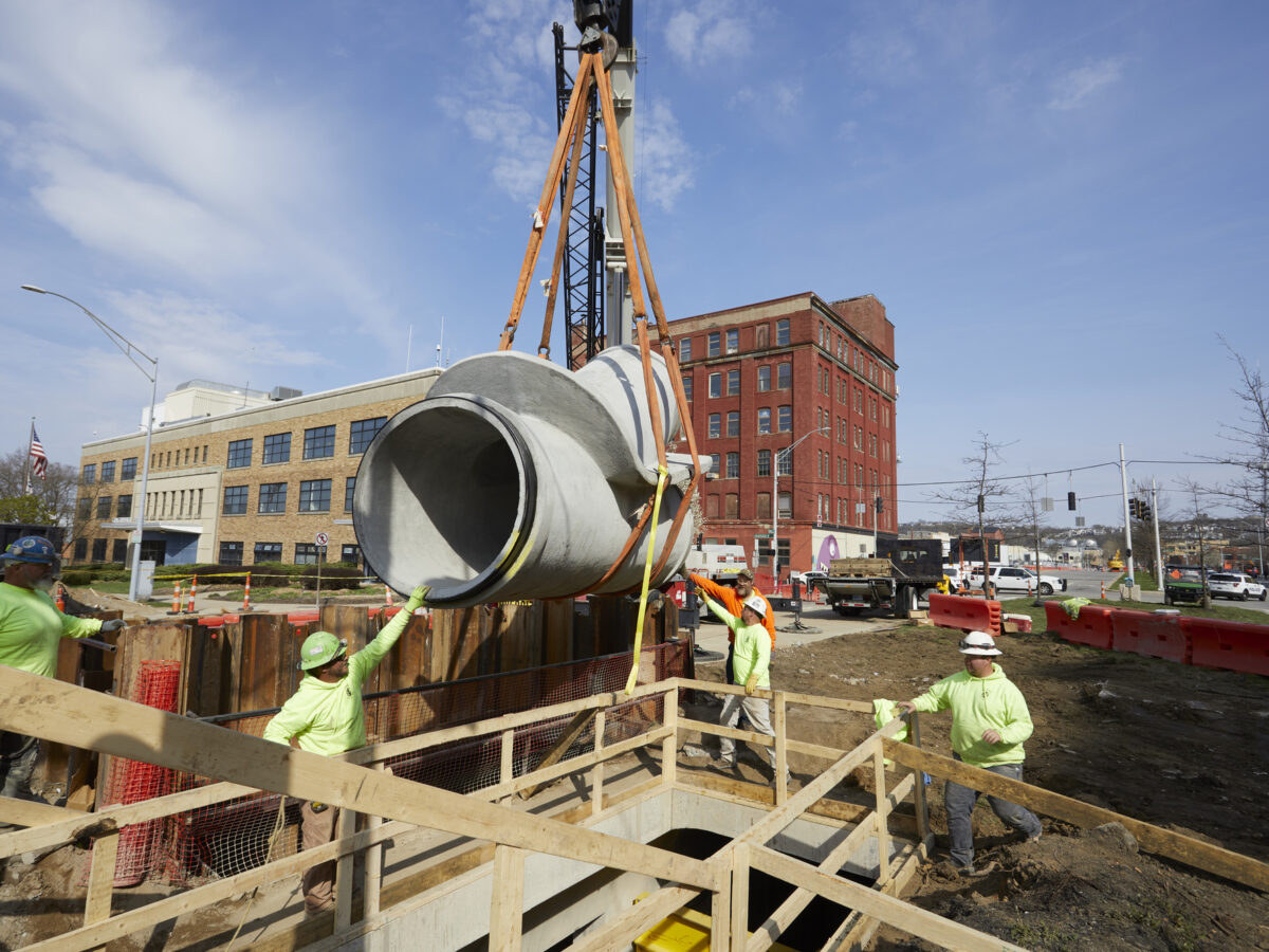

A balancing act between our desire to shape the environment to suit human purpose and the escalating impact of infrastructure development, stormwater management in urban areas is a fundamental part of designing a healthy community.
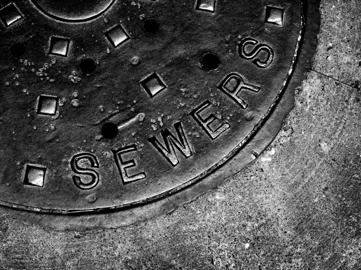
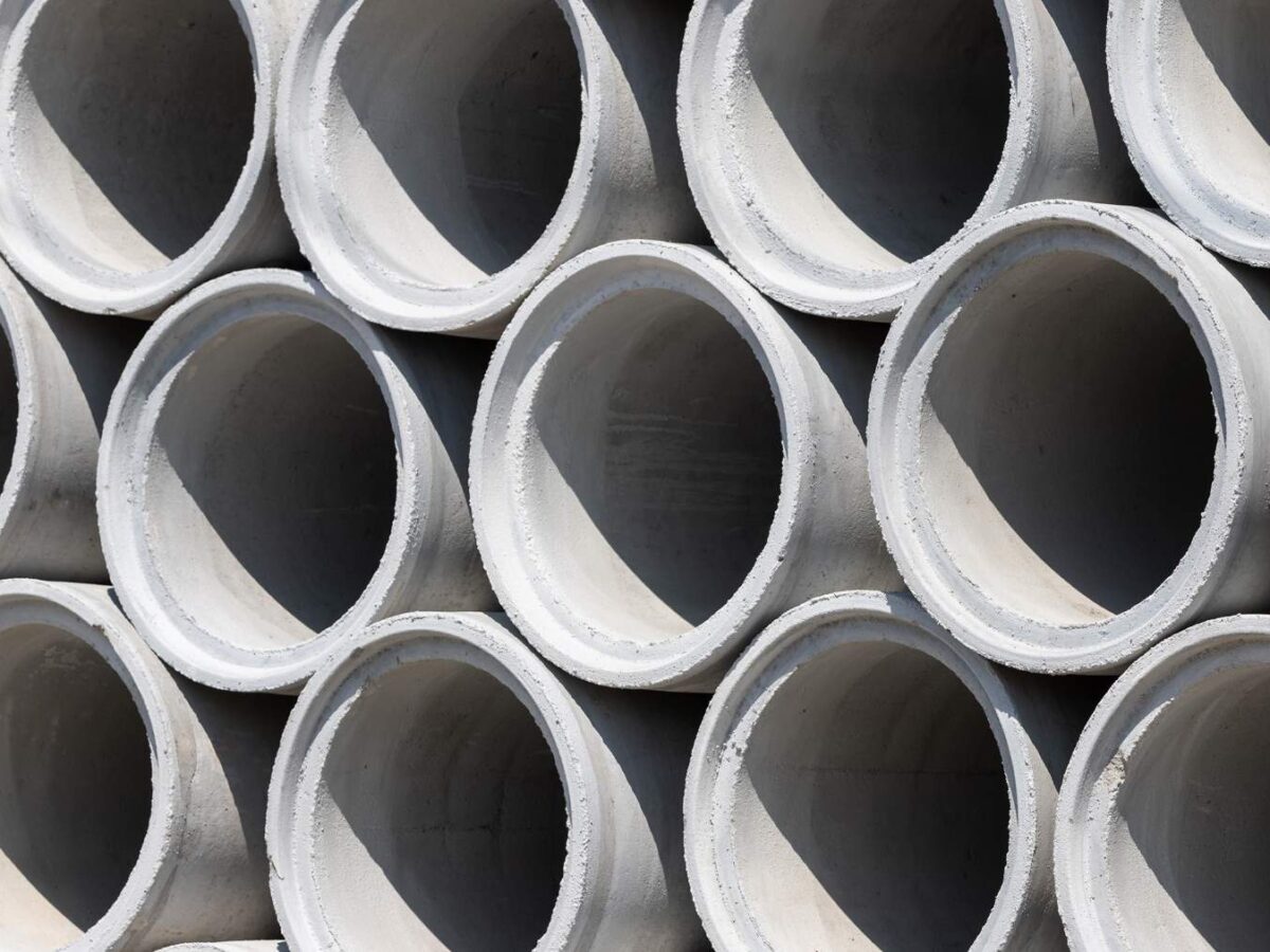
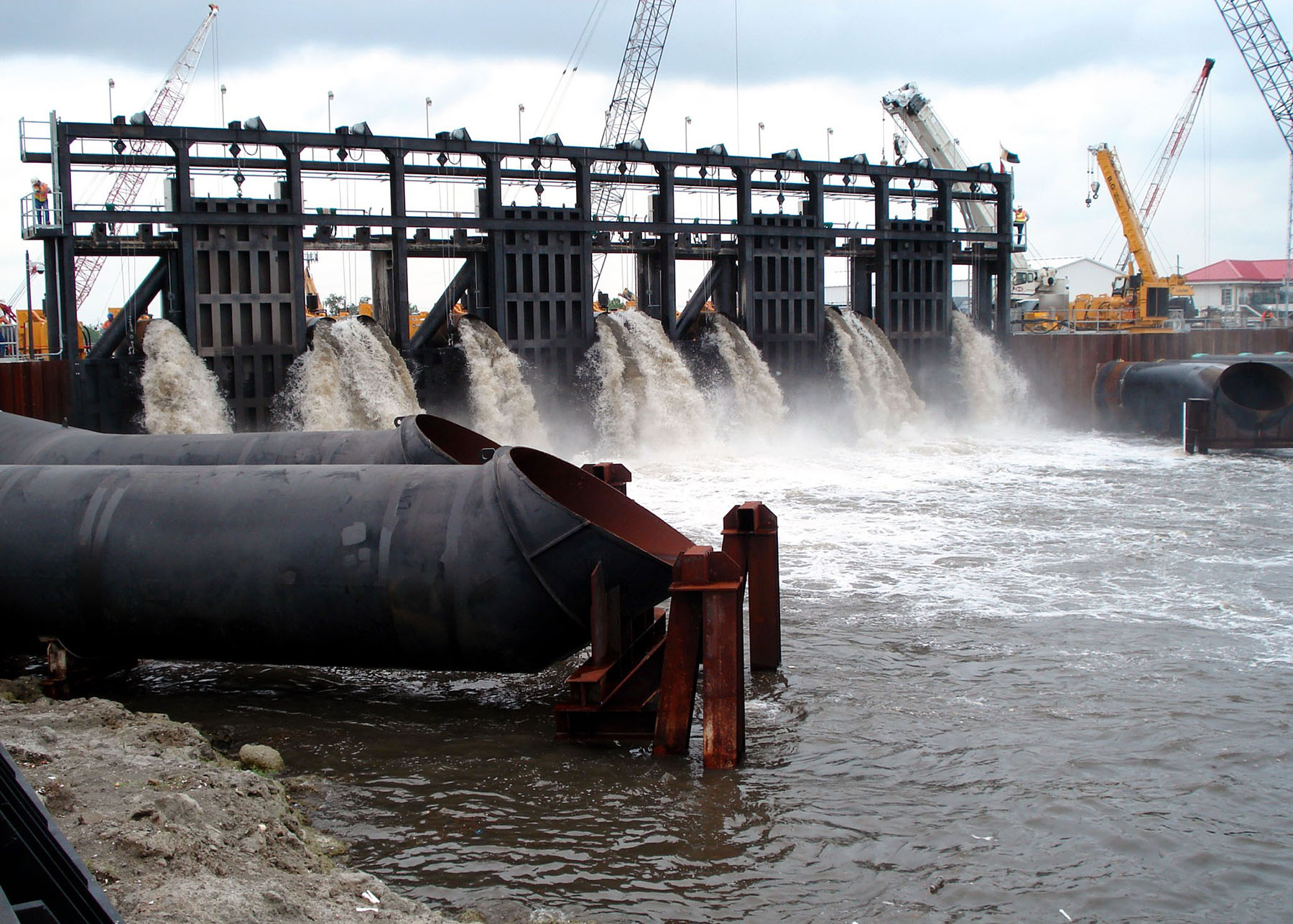
We all encounter this infrastructure daily, whether it be gutter inlets along residential roads, detention ponds adjacent to parking lots, or earthen levees along a river or the coastline. But, stormwater infrastructure is fundamentally different than most other public infrastructure systems. While roads and drinking water supply enable society to function through the transmission of goods and services, stormwater infrastructure is primarily about risk management and the protection of assets.
In a time when the frequency and intensity of weather events varies drastically, how do engineers design stormwater assets that will weather the storm? Keep reading to learn how engineers utilize what are known as “design storms,” hypothetical storms that occur at a given frequency, duration, and intensity, to design right-sized, resilient infrastructure.
A (Very) Brief History
For many decades, levees were the dominant means of flood control in the United States. But, the Great Mississippi flood of 1927, which submerged 13 million acres of land in as much as 30 feet of water, caused engineers to reevaluate. It took more than two months for the flood water to fully recede and required the entire National Guard flying unit to provide relief assistance.
Fast-forward to 2005, and the U.S. experienced 27 named storms, 14 of which were hurricanes. Hurricane Katrina in particular caused a major shift in stormwater management philosophy, shifting from an attitude of ‘protection’ to one of ‘risk reduction,’ as people acknowledged that no system is failproof and that every design must be engineered to accommodate an acceptable level of risk.
More recently, communities around the country have been in the news as high intensity storm events overwhelm infrastructure. In October 2021, Alabama experienced flash flooding with the highest official 24-hour total topping 10 inches in some areas. Not only was the daily rainfall total enough to classify the storm as a rare event, but one rain gauge recorded 7.25-inches of rainfall in three hours, which is slightly more than a 1000-year event according to the NOAA (National Oceanic and Atmospheric Administration) Atlas.
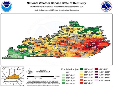
This year has been no exception: in July 2022, Kentucky experienced catastrophic flooding and the three counties most impacted were historically used for strip mining, which removes vegetation and topsoil—leaving essentially no natural elements left for water retention. The flooding was so severe that current maps used for denoting special flood hazard areas (SFHA) needed to be updated.
Most recently, we saw Hurricane Ian devastate significant parts of Florida, causing severe flooding and damage to communities. The cause of Ian’s rapid increase in strength prior to landfall and the total damage that it caused will likely be studied for years to come.
The Importance of Design Storms
To right-size stormwater infrastructure to withstand extreme weather events like the ones mentioned above, engineers often use a design storm, which is described as the severity of storm that a given structure is designed to endure before “failure.” It’s important to note that failure is not always catastrophic—in the case of roadway drainage, failure could be as mundane as light water ponding on the road.
Design storms contain two elements: the occurrence frequency and storm duration. They are usually represented by terms like 2-year/24-hour, 25-year/2-day or 100-year/30-minute. The occurrence frequency describes how often an event is likely to occur. Thus, a 2-year storm has a one in two chance of occurring every year. Similarly, a 100-year storm has a one in 100, or one percent chance of occurring in any given year. Additionally, the frequency denoted for a given storm doesn’t guarantee that the storm of a given severity will not occur more (or less) often than what is statistically normal. This means that a 100-year storm can occur in back-to-back years; one rare storm does not reduce the chance that a rare event will occur within the same or following years.
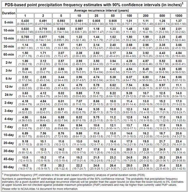
Baked into the idea of storm frequency is also storm intensity. The conditions that lead to more intense storms are less common than those that cause less intense storms. We see this regularly: summer showers pop up frequently, but intense summer storms that can cause catastrophic flooding are less common. The table below shows the recurrence interval, duration, and intensity of design storms in the Birmingham, Alabama area.
The second element of a design storm is the duration of the storm. The appropriate duration of design storm depends on the size, ground cover, land use and topography of a given watershed, as well as the design application. All these factors contribute to what is known as “time of concentration,” which is the time required for the most hydraulicly-remote point of a watershed to contribute to runoff discharge. To obtain the peak discharge in each system, the design storm must have a duration that is at least as long as the time of concentration.
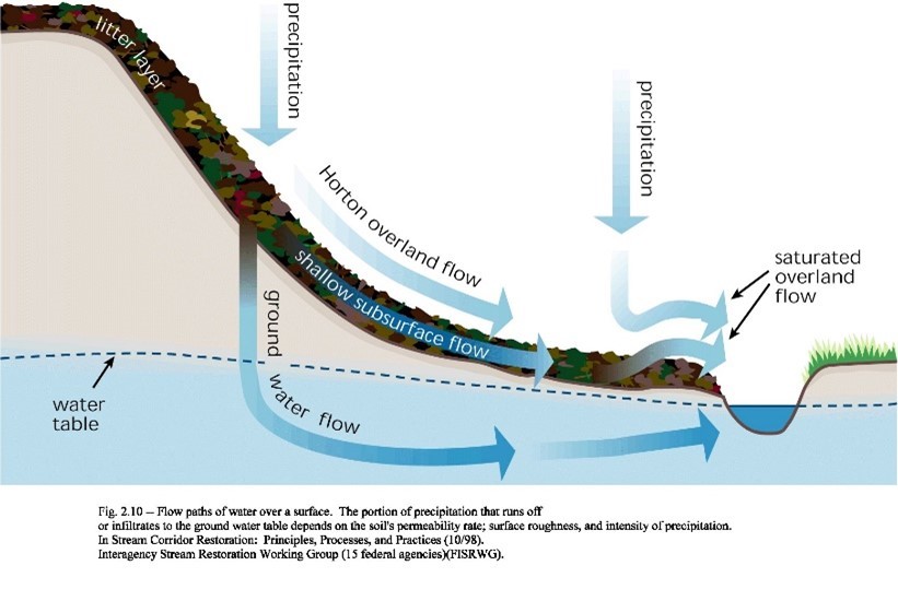
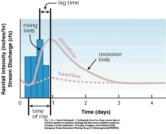
To model design storms, engineers can use measured precipitation values in an area and/or synthetic information. Using these values, hyetographs plot the rainfall intensity and time, usually in inches/hour, that occurs over a watershed. However, not all this water reaches the conveyance structures that engineers design. Some rainwater is trapped as puddles and ponds (abstraction), some soaks into the soil to replenish groundwater tables (infiltration), and some accumulates on vegetation and evaporates (interception). Observed and theoretical hydrographs— graphs showing the discharge runoff from a watershed at a specific outlet over time—have all these factors-built in.
Putting it To the Test
Engineers determine which design storm is required for designing a structure based on multiple factors. What regulatory and governmental requirements exist? What is the client and/or municipality’s acceptable level of risk? What are the loss of life and property risks of failure?
Design storm selections are also heavily influenced by the type of structure. For instance, a hospital will require greater protections than a residential home. Engineers must weigh all of these factors, and more, to determine what design storm should be used.
While design storms are at the core of the current approach to stormwater infrastructure design, simply selecting a design storm does not solely determine the required capacity of a stormwater system. The Rational and NRCS (National Resources Conservation Service) methods are two of the most common methods used to determine how much stormwater runoff must be conveyed by collections systems for a given design storm. Of the two methods, NRCS is generally more reliable for larger watersheds that have varied land uses. Numerous other industry standard methods and models are also available to designers.
It should also be noted that engineers are often required to use design storms when modeling sanitary sewers, even if it’s not a combined sanitary and stormwater system. In an ideal world, a dedicated sanitary sewer would only convey wastewater, but stormwater and groundwater often find their way into these systems.
In Conclusion
Stormwater infrastructure is a vital part of keeping communities healthy and protecting vital assets. Without drainage, conveyance and transmission systems that are prepared to handle an influx of precipitation, significant damage to property can occur during intense periods of rainfall.
Stay tuned for my next blog post where I’ll discuss alternative design methods for stormwater infrastructure and the mounting evidence that we may be designing our structures for conditions that no longer persist.